NYC Cycling Map + Graphic
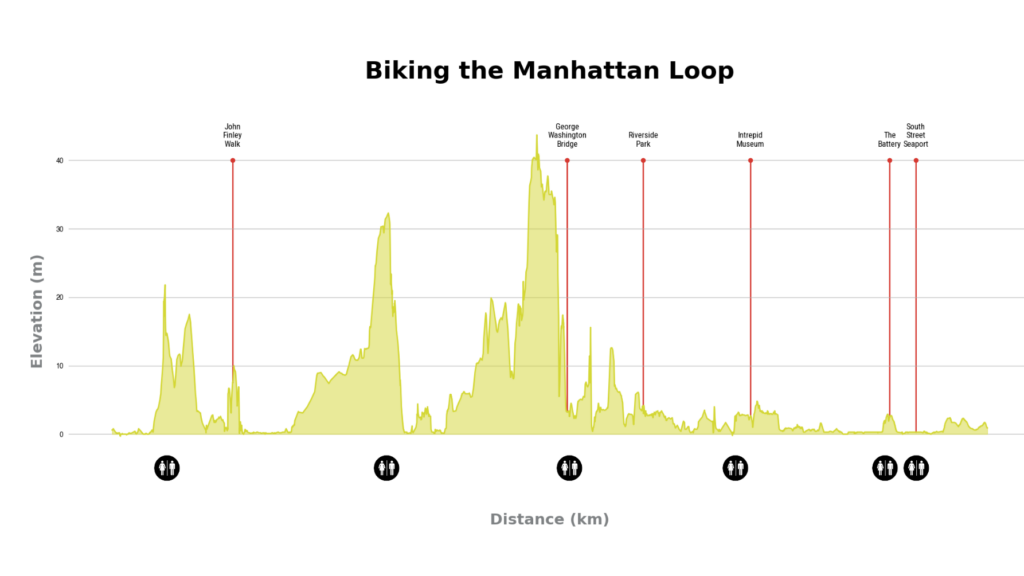
NYC Cycling Map + Graphic A Data-Driven Cycling Map As a cyclist and map enthusiast, I wanted to create a rich, interactive map of the Manhattan Waterfront Greenway, incorporating not only the bike route itself but also Points of Interest (POIs) and restroom locations. This project integrates multiple datasets, including a GPX tracks, geospatial data […]
Google Earth Studio And After Effects Animation for Trail Map
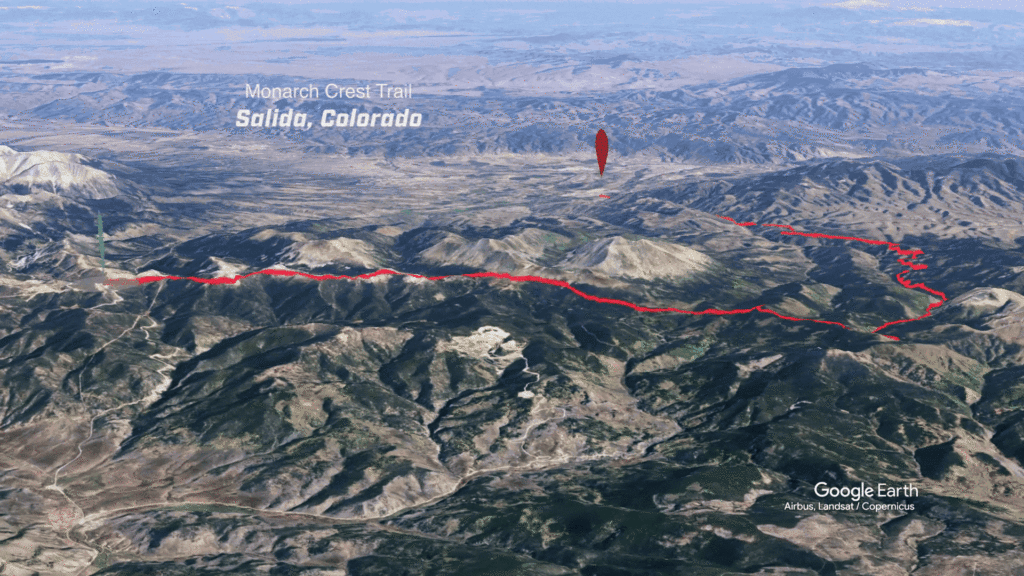
I may be sitting in front of the computer during a deep winter freeze but I’m secretly dreaming of some of the places I would love to ride and bring my family someday. Many of the Colorado trails top my list including the Monarch Crest Trail in Salida, Colorado. Getting Started: Read moreElevation Map in […]
Calculating Proximity to Earth’s Core: Fun with Folium and Skyfield

I had a lot of fun getting familiar with the Skyfield API and making a list of the cities that I’ve visited to see which one is closer to the center of the earth. It turns out that London is the winner, at 6365.10 km to Earth’s core with Vancouver, B.C. in close second. Sure, […]
Elevation Map in Blender
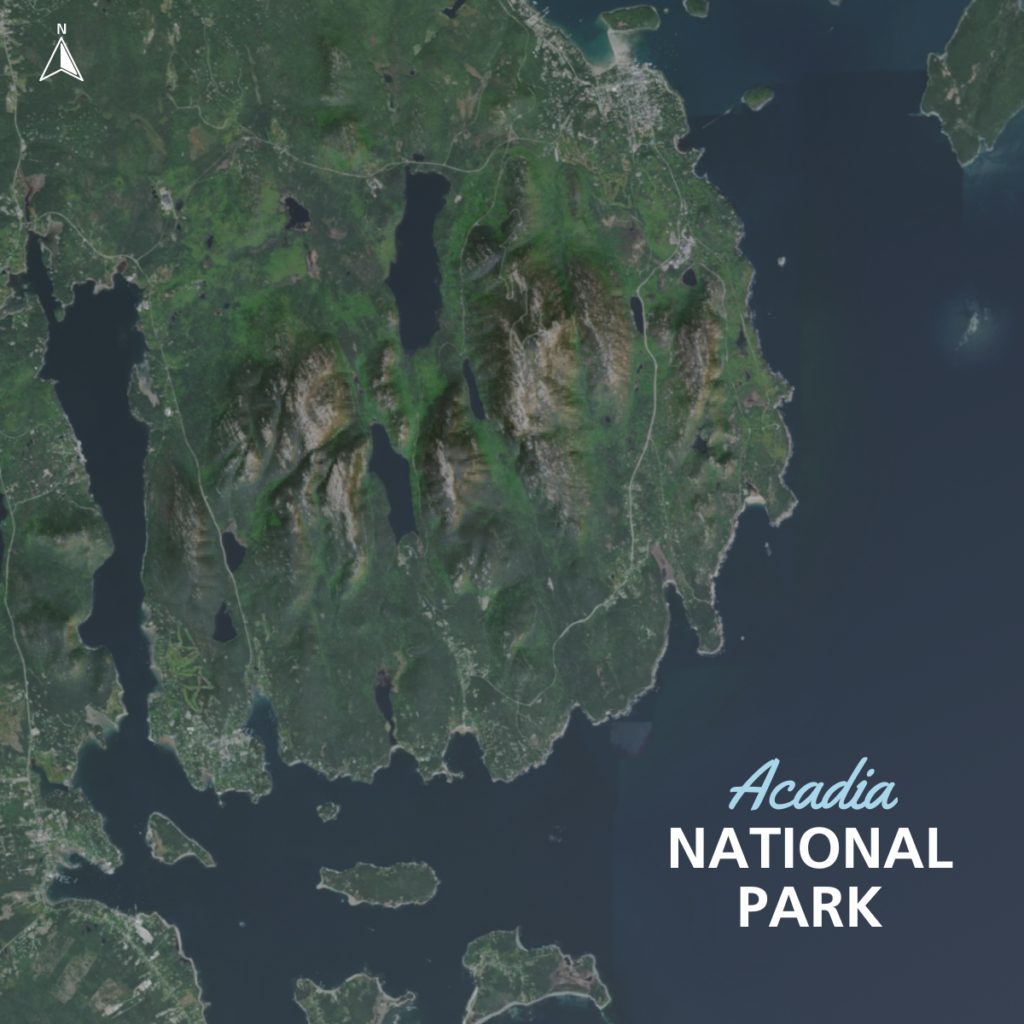
Inspired by a recent trip to Acadia camping with my family I wanted to make a elevation map that could tell a more accurate visual story about the mountains in and around the park than a standalone aerial. I downloaded a heightmap and an aerial image from here. I then imported the image and respective […]