NYC Cycling Map + Graphic
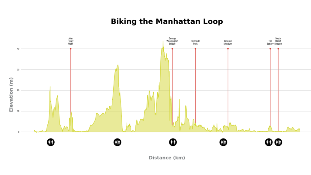
NYC Cycling Map + Graphic A Data-Driven Cycling Map As a cyclist and map enthusiast, I wanted to create a rich, interactive map of the Manhattan Waterfront Greenway, incorporating not only the bike route itself but also Points of Interest (POIs) and restroom locations. This project integrates multiple datasets, including a GPX tracks, geospatial data […]
Google Earth Engine Animated Timelapse
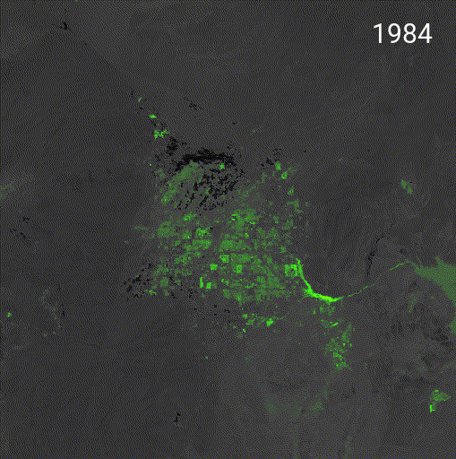
480% Growth in 40 years: A Las Vegas Growth Timelapse Las Vegas has seen explosive population growth over the past few decades. In 1984, the metro area had a population of only ~500,000—a number that has skyrocketed to an estimated 2,900,000 as of 2024. A 480% increase, making it a good case study for exploring […]
Calculating Proximity to Earth’s Core: Fun with Folium and Skyfield

I had a lot of fun getting familiar with the Skyfield API and making a list of the cities that I’ve visited to see which one is closer to the center of the earth. It turns out that London is the winner, at 6365.10 km to Earth’s core with Vancouver, B.C. in close second. Sure, […]